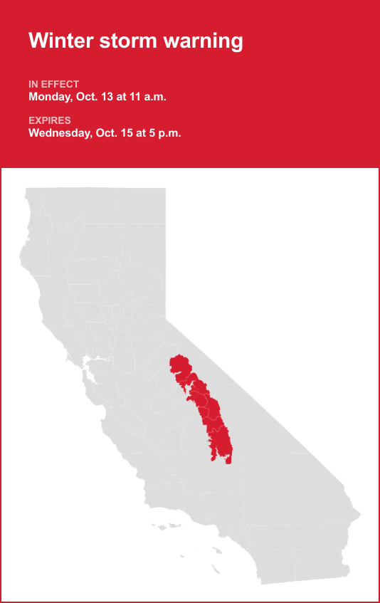
Yosemite is included in a winter storm warning released by the National Weather Service on Sunday at 12:59 a.m. The warning is valid from Monday 11 a.m. until Wednesday Oct. 15, at 5 p.m.
The NWS Hanford CA states to prepare for, “Snow levels 6000 – 7000 feet. Heavy snow possible above these levels with total snow accumulations 12 to 24 inches.”
“Visibilities may drop below 1/4 mile due to falling and blowing snow. Travel could be very difficult to impossible. The hazardous conditions could impact the Monday evening and Tuesday morning commutes,” the NWS said. “If you must travel, keep an extra flashlight, food, and water in your vehicle in case of an emergency. The latest road conditions for the state you are calling from can be obtained by calling 5 1 1. Persons should delay all travel if possible. If travel is absolutely necessary, drive with caution and be prepared for sudden changes in conditions. Leave plenty of room between you and the motorist ahead of you, and allow extra time to reach your destination. Avoid sudden braking or acceleration, and be especially cautious on hills or when making turns. Make sure your car is winterized and in good working order.”
The full list of affected locations includes:
- Yosemite
- Upper San Joaquin River
- Kaiser to Rodgers Ridge
- Kings Canyon NP
- Grant Grove area
- Sequoia NP
- South End of the Upper Sierra
Emergency alerts in Southern California
For “considerable or catastrophic” hazards, emergency alerts will be sent to all enabled mobile phones in the area. To monitor lesser risk, residents are advised to sign up for county alert systems and to monitor agencies’ social media. How to sign up for alerts in your area:
Winter weather wisdom: Driving tips from the NWS for challenging conditions
Winter’s icy grip often turns roads treacherous, leading to over 6,000 weather-related vehicle fatalities and more than 480,000 injuries each year. When you find yourself on snowy or freezing rain-slicked roads, your top priority should be safety. Slow down and exercise caution. In temperatures near freezing, it’s prudent to assume icy patches on the road and adjust your driving accordingly. Be on alert for ice accumulating on power lines and tree branches, as they may break and fall. If possible, avoid driving in these conditions altogether. But if you must venture out, choose routes with fewer trees and power lines, and never touch a downed power line. If you encounter one, dial 911 immediately. Here are additional winter weather driving tips:
Share your travel plans:
When venturing out of town in hazardous winter weather, be sure to inform family or friends of your destination, your intended route, and your estimated arrival time.
Prepare your vehicle:
Ensure your gas tank is full and equip your vehicle with essential winter supplies such as a windshield scraper, jumper cables, a small shovel, flashlight, cell phone, blanket, extra warm clothing, drinking water, and high-calorie non-perishable food.
Stay calm when stranded:
If you become stranded, stay composed. Notify someone about your situation and location. Avoid attempting to walk to safety. Attach a cloth to your car’s antenna or mirror to signal that you require assistance. Make your vehicle more visible by using the dome light and flashers.
Be mindful of snow plows:
Keep an eye out for snow plows and provide them with ample room to pass. Only overtake a plow when you have a clear view of the road ahead.
Check road conditions:
Before embarking on your journey, verify the current road conditions to make informed travel decisions.
These winter driving tips from the NWS are your key to a safer journey on snow-covered roads. By following these guidelines, you can significantly reduce the risk of accidents and ensure your well-being during challenging winter weather.